Skip to content

Explore Chitradurga

Step into Chitradurga, a land shaped by centuries of history, legendary heroes, magnificent forts, ancient monuments and breathtaking landscapes. Discover the stories of courageous rulers and warriors, explore timeless temples and archaeological treasures, and experience the rich traditions and culture of the region.

15 articles

Important Government Offices in Chitradurga DistrictAdministration

Important Government Offices in Chitradurga District

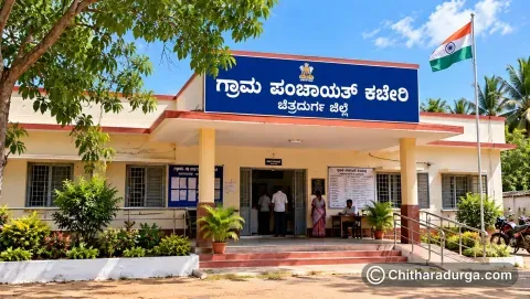
Chitradurga District has a well-established administrative network connecting the district headquarters, six taluks, urban local bodies and villages. Government offices at different levels are responsible for revenue administration, rural and urban development, law and order, agriculture, healthcare, education, social welfare, transport, infrastructure and a wide range of citizen services.

Raghavendra Padmashali23 October 20260 views
Municipalities of Chitradurga DistrictAdministration

Municipalities of Chitradurga District

Urban administration plays an important role in the development and day-to-day management of towns and cities across Chitradurga District. While Gram Panchayats and other Panchayat Raj institutions serve rural areas, urban settlements are administered through Urban Local Bodies (ULBs) constituted under Karnataka's municipal administration system.

Raghavendra Padmashali23 October 20263 views
Hoblis of Chitradurga DistrictAdministration

Hoblis of Chitradurga District

The Hobli is an important unit of revenue administration in Karnataka, functioning between the Taluk and Village levels. Chitradurga District is divided into 6 taluks and 22 hoblis, which together provide an organised administrative framework for hundreds of villages across the district.

Raghavendra Padmashali23 October 20264 views
Taluks of Chitradurga DistrictAdministration

Taluks of Chitradurga District

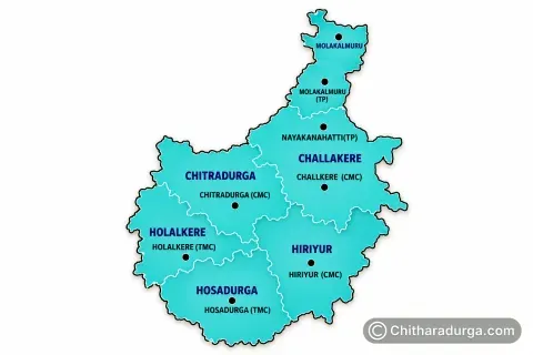
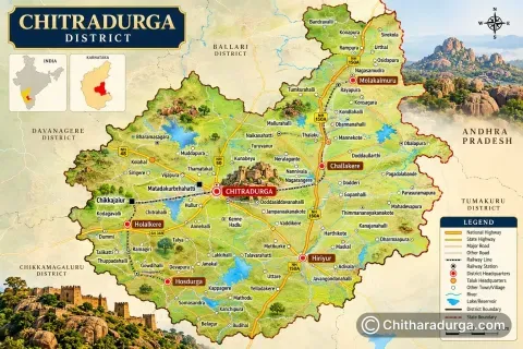
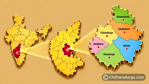
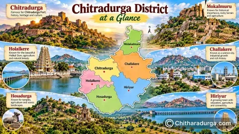
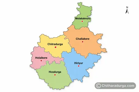
Chitradurga District, located in central Karnataka, is administratively divided into six taluks — Chitradurga, Challakere, Hiriyur, Holalkere, Hosadurga and Molakalmuru. Together, these taluks cover the district's total geographical area of approximately 8,436 square kilometres and form an important link between the district administration and villages.

Raghavendra Padmashali23 October 20264 views
District Administration of ChitradurgaAdministration

District Administration of Chitradurga

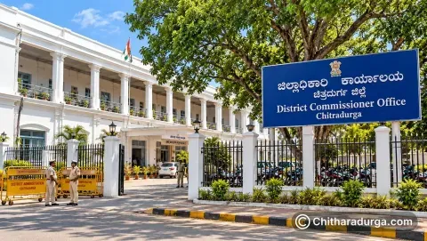
The District Administration of Chitradurga is the principal administrative machinery responsible for implementing government policies, maintaining revenue administration, coordinating development programmes and delivering essential public services throughout the district. Chitradurga city serves as the district headquarters and houses the Deputy Commissioner’s Office and several important district-level government departments.

Raghavendra Padmashali23 October 20262 views
Geographical Status of ChitradurgaGeography

Geographical Status of Chitradurga

Chitradurga District is situated in the central part of Karnataka, in southern India. Its strategic position on the Deccan Plateau gives the district a distinctive landscape dominated by rocky hills, extensive plains, scattered valleys and massive natural boulder formations. Chitradurga city, the district headquarters, lies approximately 200 kilometres northwest of Bengaluru and serves as an important connecting point between northern and southern Karnataka.

Raghavendra Padmashali23 October 20264 views
Origin of the Name ChitradurgaAbout the District

Origin of the Name Chitradurga

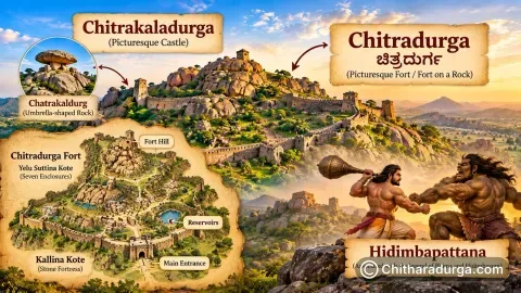
The district administration records that Chitradurga derives its name from “Chitrakaladurga,” interpreted as “Picturesque Castle.” Karnataka Tourism also records a tradition connecting an earlier form, “Chatrakaldurg,” with an umbrella-shaped rock formation near the town. Historical inscriptions and traditions have referred to the settlement by several names over different periods.

Raghavendra Padmashali23 October 20261 views
Chitradurga at a GlanceAbout the District

Chitradurga at a Glance

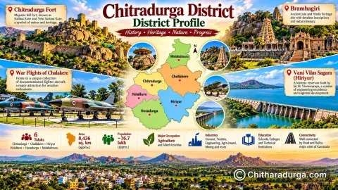
Chitradurga is one of the 31 districts of Karnataka, with Chitradurga city serving as its district headquarters. The present district covers approximately 8,436 square kilometres. Administratively, the district consists of six taluks: Chitradurga • Challakere • Hiriyur • Holalkere • Hosadurga • Molakalmuru

Raghavendra Padmashali23 October 20261 views
District ProfileAbout the District

District Profile

Chitradurga possesses a remarkable historical sequence extending from prehistoric settlements to the modern period. Chitradurga is famous for a terrain dominated in many places by granite hills, rocky outcrops, valleys and open plains. A large part of Chitradurga's social and economic life has traditionally been connected with agriculture, livestock and rural occupations.

Raghavendra Padmashali23 October 20262 views