Taluks of Chitradurga District
Taluks of Chitradurga District
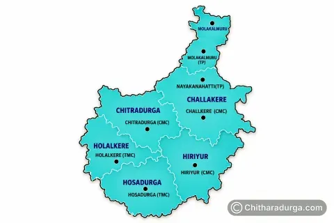
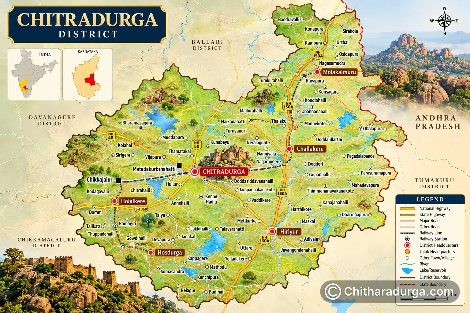
Chitradurga District, located in central Karnataka, is administratively divided into six taluks — Chitradurga, Challakere, Hiriyur, Holalkere, Hosadurga and Molakalmuru. Together, these taluks cover the district's total geographical area of approximately 8,436 square kilometres and form an important link between the district administration and villages.
Each taluk has its own Tahsildar Office for revenue administration and a Taluk Panchayat for rural development and local governance. The taluks are further divided into hoblis, Gram Panchayats and villages, creating a decentralised administrative structure through which government services and development programmes reach people across the district.
Role of a Taluk in Administration
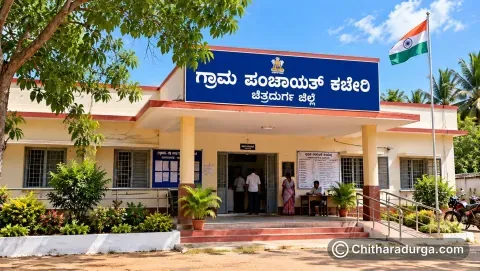
A taluk is an important administrative division between the district and village levels. It brings government administration closer to citizens and provides a convenient centre for accessing various public services.
The Tahsildar is the principal revenue officer at the taluk level. The Tahsildar's Office deals with revenue administration, land-related matters, government land, various certificates, election-related duties, disaster response and other responsibilities assigned by the government.
Alongside revenue administration, every taluk in Chitradurga District has a Taluk Panchayat. It forms the intermediate level of the three-tier Panchayat Raj system, between the Zilla Panchayat and Gram Panchayats.
The Taluk Panchayat is administratively headed by an Executive Officer (EO) and coordinates various rural development activities within the taluk.
1. Chitradurga Taluk
Chitradurga Taluk is administratively important because it contains Chitradurga city, the headquarters of Chitradurga District. The Deputy Commissioner's Office, Zilla Panchayat, District Police administration and numerous district-level government offices are located in the city.
The taluk covers approximately 1,383 sq. km. It combines the urban centre of Chitradurga with a large rural hinterland consisting of villages and agricultural areas.
Chitradurga Taluk currently has 38 Gram Panchayats, making rural administration and development an important part of its governance.
The Tahsildar Office, Chitradurga, manages taluk-level revenue administration, while the Taluk Panchayat, Chitradurga, coordinates rural development programmes and works with Gram Panchayats within its jurisdiction.
Because it is located at the district headquarters, Chitradurga Taluk also provides access to many higher-level government offices that serve people from across the district.
Important Administrative Offices
Tahsildar Office, Chitradurga
Near I.B., B.D. Road, Chitradurga – 577501
Taluk Panchayat, Chitradurga
Opposite KSRTC Depot, Chitradurga – 577501
2. Challakere Taluk
Challakere Taluk is the largest taluk in Chitradurga District by geographical area, covering approximately 2,074 sq. km. Challakere town serves as its administrative and commercial centre.
The taluk is characterised by extensive rural areas, agriculture, villages and a growing urban centre. In recent decades, the Challakere region has also gained prominence because of the establishment of major science, research and strategic institutions in and around the taluk.
Challakere has 40 Gram Panchayats, the highest number among the six taluks of Chitradurga District.
The Tahsildar Office handles revenue and land administration, certificates and other government functions, while the Taluk Panchayat coordinates rural-development activities across the taluk.
With its large geographical extent and numerous villages, effective decentralised administration is particularly important in Challakere Taluk.
Important Administrative Offices
Tahsildar Office, Challakere
Ambedkar Circle, Chitradurga Road, Challakere – 577522
Taluk Panchayat, Challakere
Chitradurga Main Road, Challakere – 577522
3. Hiriyur Taluk
Hiriyur Taluk occupies an important position in the southern part of Chitradurga District. It covers approximately 1,703 sq. km, making it one of the district's larger taluks.
Hiriyur town is a major commercial, agricultural and transportation centre. Its location along an important highway corridor strengthens its connection with Chitradurga, Tumakuru, Bengaluru and other parts of Karnataka.
One of the most important geographical landmarks associated with Hiriyur Taluk is Vani Vilasa Sagara, popularly associated with Marikanive. The reservoir has played an important role in the region's irrigation history and development.
Hiriyur Taluk has 33 Gram Panchayats. The Tahsildar Office manages revenue administration, while the Taluk Panchayat coordinates development programmes in its rural areas.
Agriculture, irrigation, trade and transportation have an important influence on the social and economic life of the taluk.
Important Administrative Offices
Tahsildar Office, Hiriyur
Beside SBI Bank, Hiriyur – 577598
Taluk Panchayat, Hiriyur
Opposite Tahsildar Office, Hiriyur – 577598
4. Holalkere Taluk
Holalkere Taluk lies in the western part of Chitradurga District and covers approximately 1,099 sq. km.
The taluk includes Holalkere town and numerous villages surrounded by agricultural lands, hills and varied rural landscapes. Its geographical position connects Chitradurga District with regions towards Davanagere and other parts of central Karnataka.
Holalkere Taluk currently contains 29 Gram Panchayats.
The Tahsildar Office, Holalkere, serves as the main centre for taluk-level revenue administration. The Taluk Panchayat coordinates rural-development activities and works with the Gram Panchayats within the taluk.
The administration plays an important role in supporting agriculture, drinking-water facilities, sanitation, rural roads, education, welfare programmes and other essential public services.
Important Administrative Offices
Tahsildar Office, Holalkere
Near Indira Canteen, Chitradurga Road, Holalkere – 577526
Taluk Panchayat, Holalkere
Shimoga Road, Holalkere – 577526
5. Hosadurga Taluk
Hosadurga Taluk is situated in the southwestern part of Chitradurga District and covers approximately 1,438 sq. km.
Hosadurga town serves as the administrative and commercial centre of the taluk. The surrounding region consists predominantly of villages, agricultural areas and a landscape influenced by hills and seasonal water resources.
The taluk has 33 Gram Panchayats, which provide grassroots administration to its rural population.
The Tahsildar Office oversees revenue and land administration and other assigned government functions. The Taluk Panchayat works with Gram Panchayats and government departments to coordinate rural-development programmes.
Agriculture and allied activities form an important part of the local economy, making government programmes relating to farming, water resources, rural infrastructure and social welfare particularly significant.
Important Administrative Offices
Tahsildar Office, Hosadurga
Tarikere Road, Hosadurga – 577527
Taluk Panchayat, Hosadurga
Main Road, Hosadurga – 577527
6. Molakalmuru Taluk
Molakalmuru Taluk occupies the northeastern part of Chitradurga District and covers approximately 739 sq. km, making it geographically the smallest of the district's six taluks.
Its location near the Karnataka–Andhra Pradesh region has contributed to a distinctive cultural character. Kannada and Telugu cultural influences can be observed in parts of the region.
Molakalmuru is particularly well known for its traditional handloom weaving and Molakalmuru sarees, which have earned recognition beyond the district.
The taluk currently has 16 Gram Panchayats. Despite having fewer Gram Panchayats than the other taluks, its villages and rural communities form an important part of Chitradurga's northeastern region.
The Tahsildar Office, Molakalmuru, manages revenue administration and other taluk-level government responsibilities, while the Taluk Panchayat coordinates rural-development programmes.
Important Administrative Offices
Tahsildar Office, Molakalmuru
Beside Private Bus Stand, Molakalmuru – 577535
Taluk Panchayat, Molakalmuru
Main Road, Molakalmuru – 577535
Taluk Panchayats and Their Role
Each of Chitradurga District's six taluks has a Taluk Panchayat. It forms the middle tier of the Panchayat Raj system:
Zilla Panchayat → Taluk Panchayat → Gram Panchayat
Taluk Panchayats coordinate and supervise various development activities involving Gram Panchayats within their jurisdiction.
Their functions include areas such as rural drinking-water facilities, sanitation, primary-school infrastructure, monitoring certain Gram Panchayat activities and implementation of development programmes assigned under Karnataka's Panchayat Raj framework.
Each Taluk Panchayat has an administrative structure headed by an Executive Officer.
Standing committees dealing with areas such as general administration, finance and planning, and social justice support the functioning of Taluk Panchayats.
Tahsildar Offices and Their Role
While Taluk Panchayats primarily focus on rural development and decentralised governance, the Tahsildar Office is central to revenue administration.
The Tahsildar works under the district revenue administration and handles responsibilities connected with land and revenue matters, government land, records, certificates, election duties and other statutory functions.
The Tahsildar is supported by revenue officials working at different levels, creating an administrative chain extending from the taluk headquarters to hoblis and villages.
Citizens commonly approach Taluk Offices for various revenue-related services and certificates.
Taluk-wise Administrative Profile
Taluk | Approx. Area | Gram Panchayats |
|---|---|---|
Chitradurga | 1,383 sq. km | 38 |
Challakere | 2,074 sq. km | 40 |
Hiriyur | 1,703 sq. km | 33 |
Holalkere | 1,099 sq. km | 29 |
Hosadurga | 1,438 sq. km | 33 |
Molakalmuru | 739 sq. km | 16 |
Total | 8,436 sq. km | 189 |
Six Taluks – One District
The six taluks represent the remarkable geographical, economic and cultural diversity of Chitradurga District. Chitradurga functions as the district administrative centre; Challakere combines a vast rural region with emerging scientific importance; Hiriyur is closely connected with agriculture, transportation and Vani Vilasa Sagara; Holalkere and Hosadurga represent important agricultural and rural regions; while Molakalmuru adds its distinctive border-region culture and celebrated handloom tradition.
Together, the Tahsildar Offices, Taluk Panchayats, Gram Panchayats and other government departments provide the administrative framework through which governance and development reach communities across Chitradurga District.